Skip to content
Get a Demo
MyEROAD Fleet Map

Every vehicle on one live map

MyEROAD Fleet Map gives instant visibility across your fleet with high-resolution, accurate vehicle tracking displayed on digital maps.

MyEROAD Fleet Map
Why it helps

What MyEROAD Fleet Map changes

Accurate vehicle and asset tracking hardware combined with intelligent software lets you go from a birdseye view of your entire fleet to a route-compliant ETA on a customer delivery in just a few clicks. It helps you ensure safety, improve job management, set and exceed customer expectations and comply with on-road restrictions.

One platform, multiple features across your whole team

EROAD’s highly accurate asset and vehicle tracking solutions deliver near real-time data straight to your back office. The Fleet Map is accessible by fleet managers, health and safety, dispatch and logistics, so no more time is wasted trying to contact drivers on the move.

Fleet management

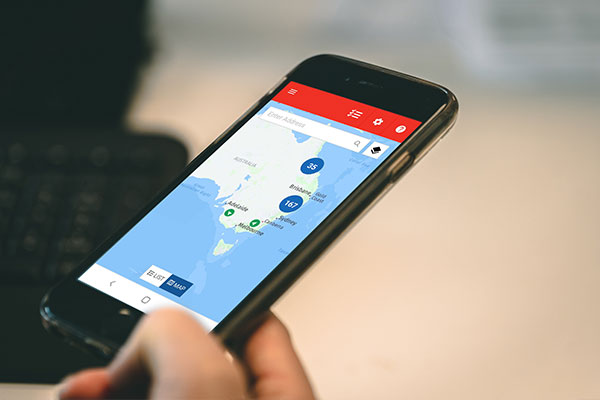
View your entire fleet with intelligent clustering, with up to 100,000 vehicles or assets displayed at one time. Locate any driver, vehicle, asset or trailer, create and view geofences, and resume where you left off after logging out.

Dispatch and logistics

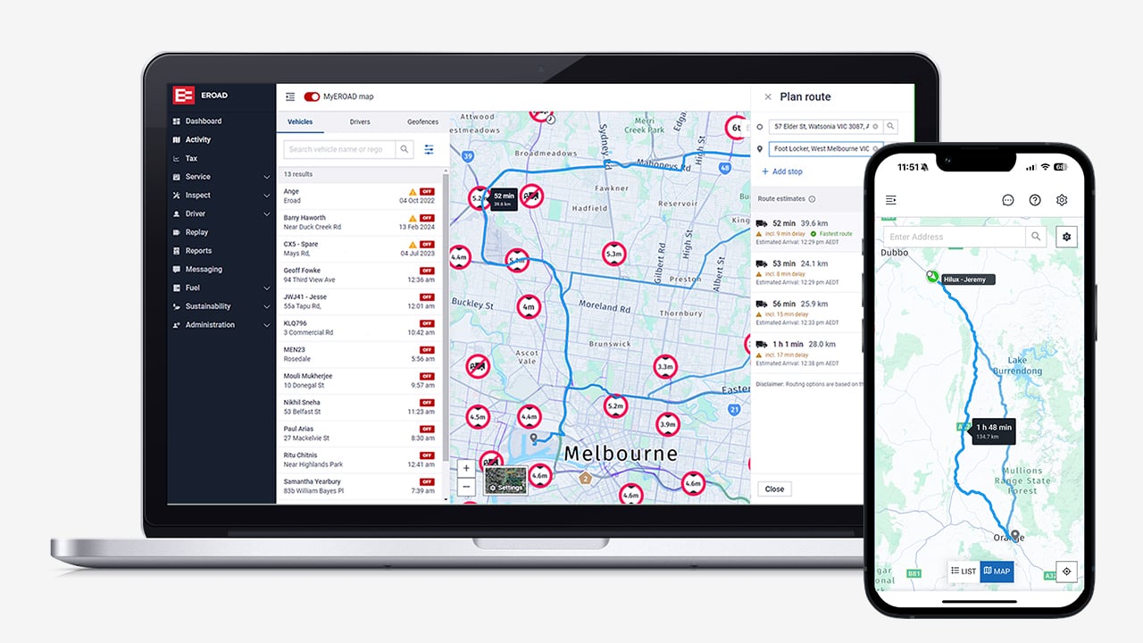
Display truck restrictions and live traffic insights, use filters to find the best route, get accurate ETAs, find the vehicle closest to a pick up or drop off, and see transport and logistics related points of interest.

See it in action

See MyEROAD Fleet Map in action

Capabilities

What it actually does

Safety and coaching

The Fleet Map gives safety teams a direct line of sight into how each vehicle is being driven. Replay routes taken with animated journey lines, see safety events during the trip, and drill down for detail on status, speed and activities.

  • View vehicle status
  • Access previous trip details
  • Investigate driving alerts and speeding locations
  • Request footage at specific journey points (access to video footage requires EROAD Clarity Solo, Get or Connected)

Intelligent route planning software

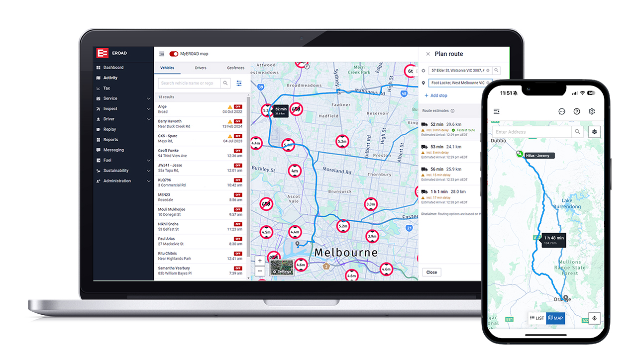
We’ve integrated EROAD’s truck, traffic and satellite map technology into our route planning and Estimated Time of Arrival (ETA) tool. By applying filters and inputting vehicle or load information, fleet managers and dispatchers can be confident in the suggested routes and journey times, knowing that important restrictions have been accounted for, such as truck weight, height, width and hazardous loads. You can also select common routes to avoid, such as tolls, tunnels and difficult turns. These restrictions and road types are clearly defined on the map, along with transport related points of interest including weigh bridge stations, loading docks and delivery entrances. Plus, the Fleet Map and route planner on the MyEROAD app work anywhere, anytime, on any connected smart device.

Route planning highlights

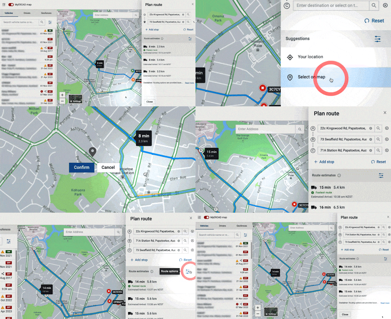
When you want to plan a route or check a vehicle’s ETA, you can get an accurate and compliant route for your vehicle and load type by simply changing the route filters. Enhanced visibility simplifies dispatch and job management, improving communication between dispatch and drivers and helping you meet agreed customer service levels.

  • Truck specific routing that considers vehicle weight and dimension restrictions
  • Avoid common obstacles like difficult turns and controlled access roads
  • Comply with road regulations including hazardous load restrictions
  • Plan routes ahead of time with configurable start points and multi stops
  • Discover transport and logistics points of interest
  • Easily re-order stops
  • Get realistic arrival times with live traffic insight
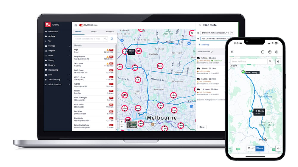
Fleet Map screen in MyEROAD Planning a route with the MyEROAD route planner MyEROAD Fleet Map screen
Customers

What it looks like in practice

It’s plain to see at any given time what’s actually happening

Before EROAD, Geoff Fry, Operational Health and Safety Manager at Lipps Natural Resources, would get a lot of questions from staff managing the trucks because they did not know what was happening. Now staff do not ask or wonder what is going on.

G Geoff FryLipps Natural Resources

Read the full case study

Works with

Part of the platform you already run

MyEROAD

Everything lands in the same portal as the rest of the fleet.

Geofencing

Entry and exit visibility for the sites that matter.

Fleet insights

Efficiency reporting and service scheduling come with the platform.

See MyEROAD Fleet Map on your own fleet

Tell us what you run and where it works, and we will show you exactly what this looks like with your own vehicles in it.