
We’re excited to announce that the MyEROAD Activity Map is getting an upgrade to deliver a superior mapping experience tailored to your fleet management needs. Keep reading for an overview of the enhancements, which will go live on Feb. 6.
This upgrade will bring the essentials to the forefront, ensuring you have the most relevant information at your fingertips.
The new base layer will show valuable map data that’s always been in the background, but wasn’t visible, including toll roads, highways, exit numbers, state borders, and heavy vehicle weight limits. This upgrade brings the essentials to the forefront, ensuring you have the most relevant information at your fingertips.
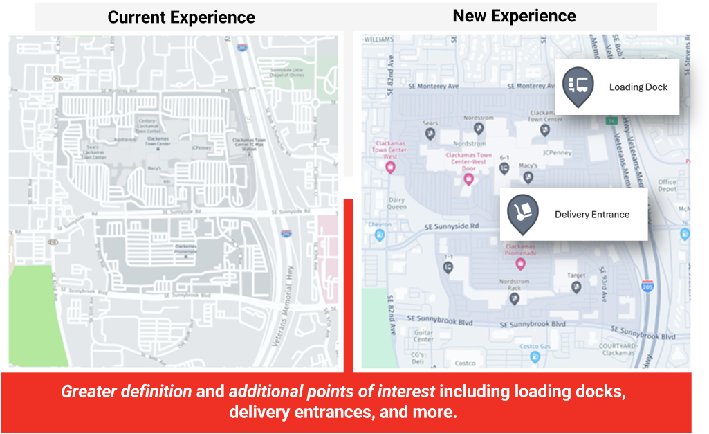
We understand the nuances of your business, and our new features reflect that. We’ve fine-tuned the map to reduce visual noise, giving prominence to points of interest crucial for transportation and logistics – things like ports, airport cargo, rest stops, delivery entrances and loading docks. Leisure areas and parks take a back seat, making room for elements that matter most to your operations.
The upgraded map defines road types with greater clarity, distinguishing between highways and toll roads. It clearly displays restrictions that may impact your route planning, offering a cleaner and more efficient navigation experience for your fleet.
Due to this upgrade, the legacy map will lose the traffic and truck map layer along with live traffic. If you’re still using the old activity map, now is the time to transition to MyEROAD to maintain access to these important features.
MyEROAD Map Upgrade Highlights
- Better definition between road types, such as highways and toll roads
- More clearly displays restrictions that could impact your route planning
- Less visual noise on the map, making it easier to identify relevant points of interest
- Displaying handy new features like exit numbers or delivery entrances make navigation easier
- New transport-specific points of interest, such as weigh stations and truck parking
- A cleaner map experience – less cluttered with leisure points of interest that aren’t as relevant to operating a business fleet
Rest assured, all the great features of MyEROAD Activity Map remain layered over the base map, including fleet tracking, geofences, smart clustering and route planner.
These map enhancements are aimed at giving you better operational visibility. Having multiple levels of visibility is crucial to effective fleet management. EROAD provides those levels of visibility with dashcams, trailer tracking and more – all through the single, integrated MyEROAD platform. Click here to learn how EROAD can deliver the actionable insights you need to transform your operations.
